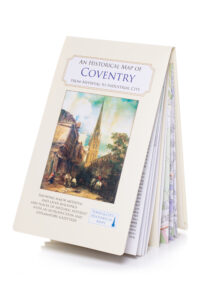
Historic Coventry Map now on sale
Medieval Coventry has partnered with the Historic Towns Trust to produce a historical map of Coventry based on the 1913 Ordinance Survey map. It shows the moment when Coventry was changing rapidly from a town with a medieval streetscape to a modern, industrial city. It is the latest in a series of maps in the Historic Towns series and puts Coventry in its rightful place as a major historic city alongside towns such as Bristol, York, Oxford and Winchester.
The map is based on the most up to date documentary and archaeological research and is therefore an enhancement on the previous map produced by Mary Lobel in 1975. On the reverse is a comprehensive gazetteer of buildings and sites of interest, together with an introductory essay by Dr Mark Webb.
The historical map is available to purchase in major bookstores and other outlets across the city for £9.99. It can also be directly obtained from the Medieval Coventry charity. Please email info@medievalcoventry.co.uk to order your copy.